

Lyon Motorbike Show
- 2026-01-30
- Culture, Tips and Tricks
For a long time overshadowed by its big brother in Milan (EICMA), the Lyon Motorcycle Show has some serious arguments to make,... Read More
In this article, we review the top 10 best navigation systems for motorcycles and bikers, depending on your needs and/or riding philosophy.
In short |
|
[updated October 2024]
Whether you use your bike only for (long) road-trips or to commute daily, the ability to find your destination safely is often key, as you cannot stop in the middle of the traffic. Additionally, if you lead a (big) group, loosing track can be problematic as it might get tricky and dangerous to re-route the whole group. So, what are the best navigation systems out there?
And make sure to read our article about the road trip essentials (here).
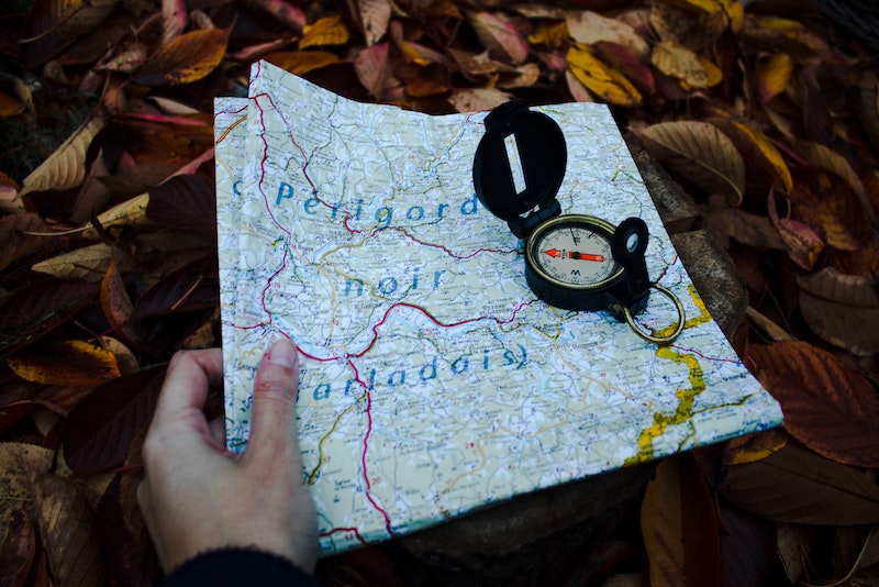
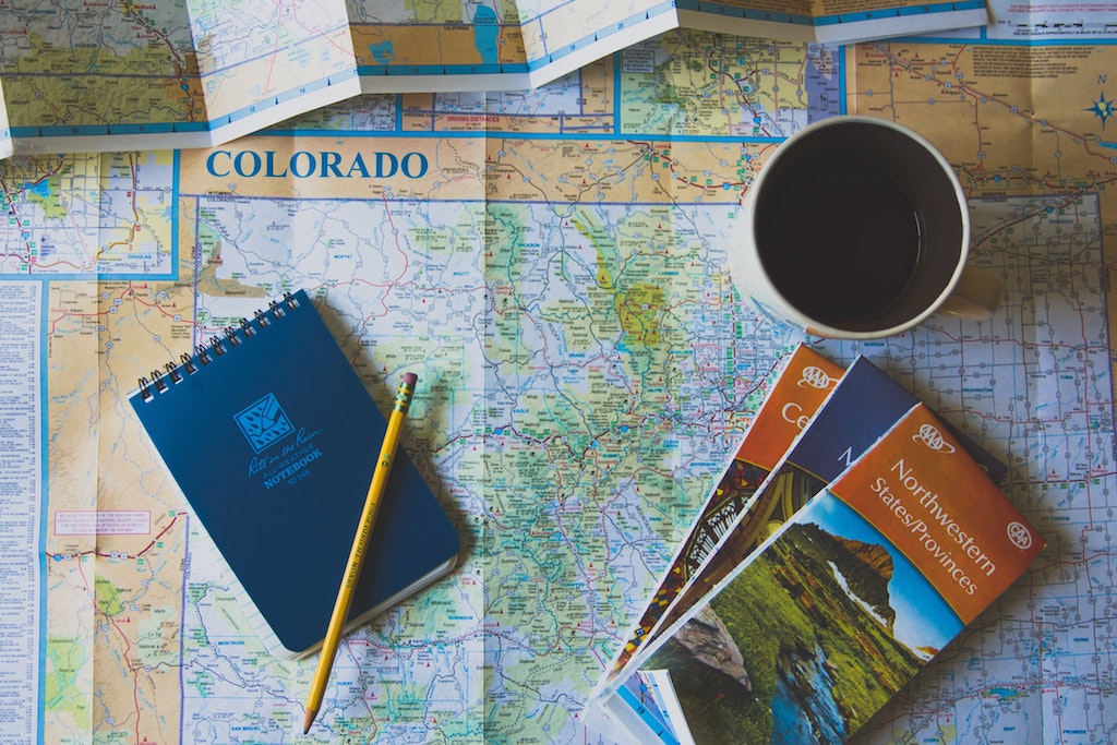
If motorbike riding means for you an open road with no particular place to go, nothing can beat the good old paper map and the compass. You stop on a sunny terrace and start planning with you riding companion(s).
Browse possible itineraries, write down the general directions on a post-it, stick it on the fuel tank, and hit the road. This is as simple as that! And sometimes, loosing yourself is the best way to discover great places and make genuine encounters with locals.
|
Pros |
Cons |
|
|
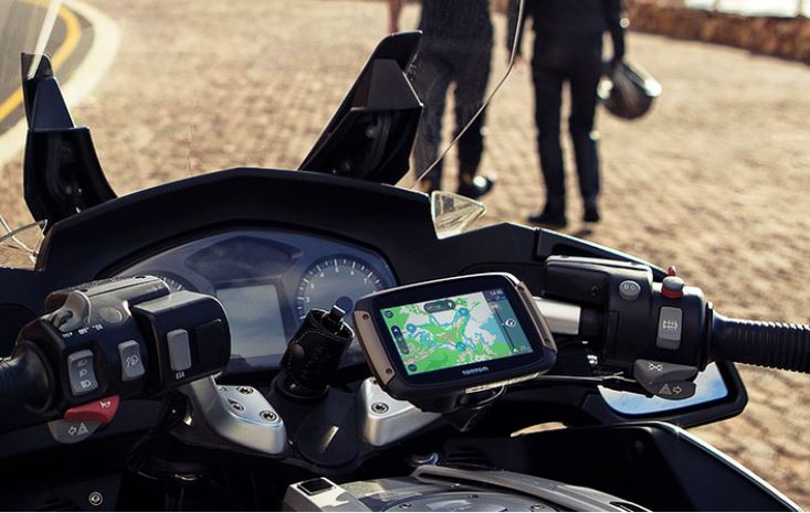
If you’re riding a brand-new high-end bike (model 2019 and up), there is a high chance you have a built-in GPS system. However, if you don’t, there are several options on the market, such as TomTom Rider or Garmin Zumo series. If you’re going on a long(er) road-trip, this might be your best option. Manufacturers offer shock/vibration resistant and waterproof devices that you can securely mount on your bike (with a lock), so no need to unplug it during every break. Additionally, you can connect them to the motorcycle’s electrical system, which means running out of battery no longer becomes a problem. Furthermore, those devices are designed to be used with your gloves on, and the screen is legible even with direct (sun)light. Motorcycle GPS do not require network coverage (GPS signal is enough).
TomTom/Garmin offer route options, such as winding roads which takes you on itineraries with a lot of twisties. Though, planning and importing an itinerary isn’t the most user-friendly experience. Either you do it on a computer and export it on the memory card or over Wi-Fi (GPX file). Or you can do it directly on the device. But if you want to change the itinerary, you have basically to start from scratch. Third party integration/live information are not as reliable as services such as Google Maps.
|
Pros |
Cons |
|
|
navigation systems for motorcycle

Beeline is some sort of a hybrid apparatus, which consists of a small device (mounted on the bike) with basic information and a smartphone app. You have the best of both worlds in a sense, that is you can plan your itinerary on your smartphone and then share it with the device over Bluetooth.
But you can also create a route on your computer (eg in Google Maps) and export it as .GPX to the Beeline via the app. The device will then tell you the minimum information, which helps you to focus on the road and not the screen.
The device also has a compass function, which shows you the general direction to follow and lets you progress to the destination as you wish.
Pros |
Cons |
|
|
Want to know more? Read our detailed product review after more than 3 years of use (here).
In 2024, Beeline released a new version of its Moto GPS. What does it have that its predecessor didn’t? Click on the image to discover our test.
 Link: https://beeline.co/
navigation systems for motorcycle
Let’s ask it upfront! Who doesn’t own a smartphone nowadays? And since it’s the single device that we carry with us at all time, why don’t we use it as a navigation system?
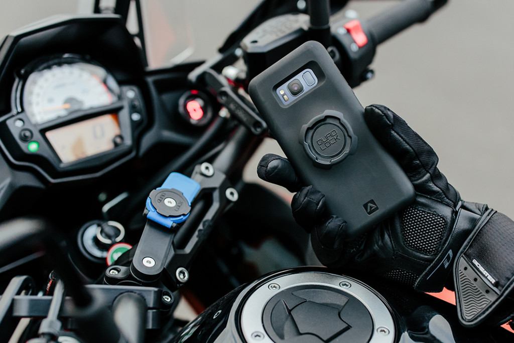
Firstly, there are several providers when it comes to the mounting system. Personally, here at Cruizador, we use the Quadlock-System, which consists of a motorcycle mount and then either a Quadlock Smartphone Case (availability depends on your smartphone/model) or, if your smartphone is not compatible, you can purchase a universal adaptor that you stick on your smartphone/case (a bit like for GoPro). It costs around 20CHF just for the adaptors, and around 80 CHF for the package (mount + case).
However, we have to warn you. Some users have reported that an extended use on bumpy roads has literally broken their smartphone because of the vibrations (screen became blurry/yellowish). Additionally, using it under driving rain or in the dust is not recommended. Even if most current high-end smartphones are IP67 certified, they are not made to be used under pouring rain for instance. So please bear that in mind if you’re going for a long road trip in difficult conditions.
[Update 2021] Quadlock has launched a “vibration dampener”. This part, which is added to the Quadlock mount (so no need to buy the whole system again) is supposed to reduce vibrations thanks to a system of foam pads. We weren’t able to test it in real conditions, however the first reviews are quite encouraging.
Last but not least, some handlebars are not compatible with the mount (has to be cylindric).
Pros |
Cons |
|
|
Link: https://www.quadlockcase.com/collections/shop-moto
Now we will look into some of the most commonly known navigation apps available. All of them are available for Android and iOS. All of them offer navigation features, with basic planning features such as “avoid motorways” or avoid paid/toll roads. So for this review, we will focus on the main pros/cons respectively the unique features of each one of them.
Common downsides of smartphone apps are the battery use (autonomy) and the necessity to have cellular data or to get guidance. Some of them allow you to download the map whilst on Wi-Fi to use them offline, but still you’ll need at least network coverage to get geo-localized.
We will handle these two as a bundle, since they share the same mother company and DNA (Google acquired Waze in 2013). It means that those two Apps share the same features to a large extent. However, we like the Waze User Interface (UI) slightly better.

Main upside of Google/Waze are the 3rd-party integration (e.g. find cheapest gas station in the area) and the live traffic information, i.e. the ability to re-route you depending on the road congestion. The technology is simple. The algorithm will analyze real time information of the users and if you’re slowing down or if many users are stuck in one place, it will conclude that there is traffic jam and re-route the other users to avoid it. So, if you commute in (congested) urban areas, you might definitely use them.
Additionally, as a user, you can notify directly in the app road hazards, camera, police along the way, which benefits other users in the area.
Pros |
Cons |
|
|
Link: https://www.waze.com/
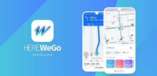
Same underlying concept as the previous one, except that you can download the map over Wi-Fi to use them offline. Additionally, you can set-up speed-limits in the system (e.g. if you’re riding 20km/h above speed limit), so if you tend to drive a bit too fast, this might be a friendly reminder 🙂 !
|
Pros |
Cons |
|
|
Link: https://wego.here.com/
If you’re planning a road-trip in Western Europe and especially France, this is THE app to use.
Whilst the underlying concept is identic, the main feature of this app is the integration of the points of interest along the way. When you plan your itinerary, choose the option “discovery” and the app will take you on the best scenic roads. Pretty high chance that it will double up your traveling time but who cares right? When we’re on a road trip, we want to spend as much time on the bike as possible 🙂 !

Michelin is a French company yet well known worldwide for its Michelin Guide (Restaurant) but also for its paper maps. So if you want to combine gastronomy and road-trip, do not look any further.
Now the main downside of this app is the possible time lag between your progression on the road and the one in the app which makes the navigation in urban areas (where changes of direction are numerous) a bit tricky.
Pros |
Cons |
|
|
[Update 2021: The App has been updated and now the landscape format is available (horizontal smartphone orientation)]
Link: https://www.viamichelin.com
Liberty Rider is an app launched by a French start-up which offers, on top of itinerary planning, a very interesting features, i.e. the possibility to share your road-trip in real-time with specific persons (defined by you). So people can see in real time where you are and be sure you are safe. If the system detects an accident it will notify automatically the emergency services within max. 5 minutes.

Additionally, you have advanced itinerary planning features (best roads for motorcycle, level of difficulty, distance, time, etc.). You can also share your itinerary/roadbook with the community/other users.
There is a basic free version (with limited functionalities) and a premium version (4€/month).
Pros |
Cons |
|
|
Link: https://liberty-rider.com/
Rever is a US-Based start-up that offers a subtle combination of social network and itinerary planning. Basically, it is a navigation apps that allows you to download/share itineraries.

| Pros | Cons |
|
|
Link: https://www.rever.co/
navigation systems for motorcycle
This is the European twin of Rever if you want. We haven’t used it yet, so it is unclear if there are more itineraries available. But the underlying concepts are the same.
[Update 2021: Cali Moto now offers some maps for download, therefore available for offline use]

| Pros | Cons |
|
|
Link: https://calimoto.com/fr
navigation systems for motorcycle

Hey, I'm the founder and Chief Biker Officer of Cruizador. I've been a motorcyclist and travel enthusiast for a long time, and it was in 2018 that I decided to launch this new service, hoping that it would speak to as many bikers as possible who share the same philosophy and the same thirst for the great outdoors. I'd be delighted to take note of your comments, ideas for improvement, etc. Ride on!

For a long time overshadowed by its big brother in Milan (EICMA), the Lyon Motorcycle Show has some serious arguments to make,... Read More
When you spend a pretty penny on a high-end helmet like the Shoei Neotec 3, you don’t want to spoil its sleek... Read More

With nearly 2000 miles spent with the Shoei Neotec 3 helmet on our heads, used in all kinds of conditions, we’re in... Read More
[…] If you are looking for a suitable navigation tools do read our selection of our TOP 10 navigation systems […]
[…] Navigation equipment (map, GPS, smartphone, etc.). Read our article here. […]
[…] You can also read our article on the best navigation systems for bikers. […]
[…] You can also read our article on the best navigation systems for bikers. […]
[…] note: if you tend to lose your way, we’ve written a handy article on the best navigation tools for bikers ???? And for those who aren’t sure what to pack, here’s our essential road trip packing […]
[…] should you use your smartphone as a main navigation tool, you would be better off with the ViaMichelin App, for recommended routes, or Waze for real-time […]
[…] If you are looking for a suitable navigation tools do read our selection of our TOP 10 navigation systems […]